 Coming soon to Android & iPhone
GPS Field Area Measurement
Measure any field, farm or plot in seconds. Tap its corners on a crisp satellite map for the area in acres or hectares, measure distances and perimeters, keep working offline, and export to KML, GPX or GeoJSON — 20 GPS field tools in one app.
What is GPS Field Area Measurement?
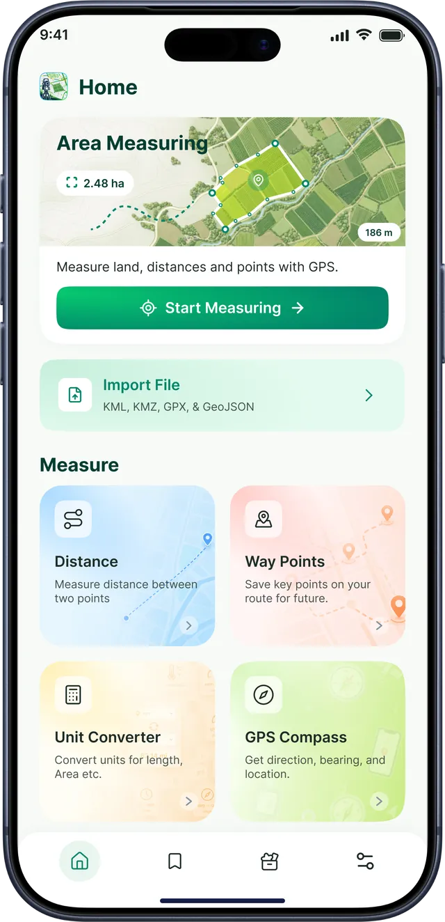
GPS Field Area Measurement is a land measuring app by TechKhedut, coming soon to Android and iOS. Tap the corners of a field on a satellite map to get its area in acres or hectares, measure distance and perimeter, work offline with downloaded maps, take GPS-stamped photos and export to KML, GPX or GeoJSON.
Your measuring wheel, in your pocket
Measure land, record field visits and share boundaries from one simple app — no tape, no paperwork, no separate GPS device.
- 20Field, GPS & conversion tools
- 7File formats to import & export
- 15Area & length units
- Offline maps for no-signal fields

Measure any field in acres or hectares — in seconds
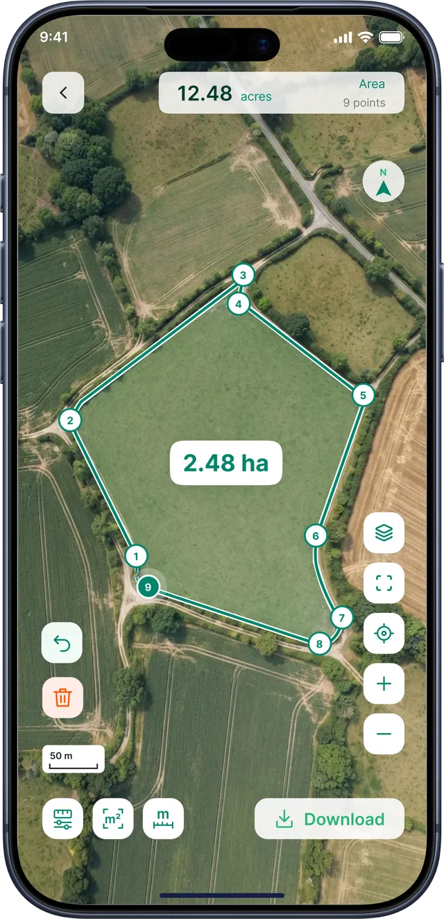
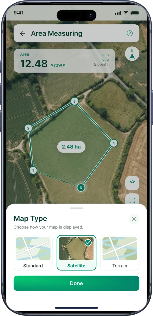
Open the satellite map, tap each corner of your field and watch the area update with every point. Drag a point to fine-tune the boundary, undo a step, and switch units whenever you like.
- Live area as you add each corner, on the map and in the header
- Area, distance or perimeter — choose what to measure in one tap
- Acres, hectares, square meters and four more area units
- Standard, satellite and terrain map types
- Drag, undo and delete points to get the boundary just right

Distances, routes and radius — measured on the map
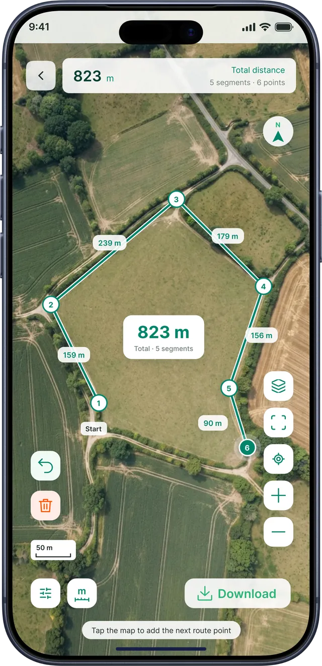
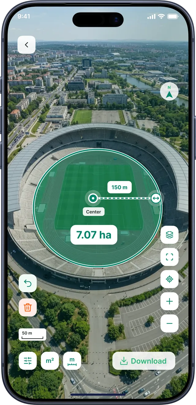
Measure the straight-line distance between two points, add stops to total up a whole route segment by segment, or drop a centre point to measure a circular area and its radius.
- Point-to-point distance with every segment labelled
- Total route distance across as many segments as you need
- Radius / circle areas for irrigation, buffers and zones
- Perimeter of any boundary for fencing and planning
- Meters, kilometers, miles, feet and more

No signal in the field? Keep measuring.
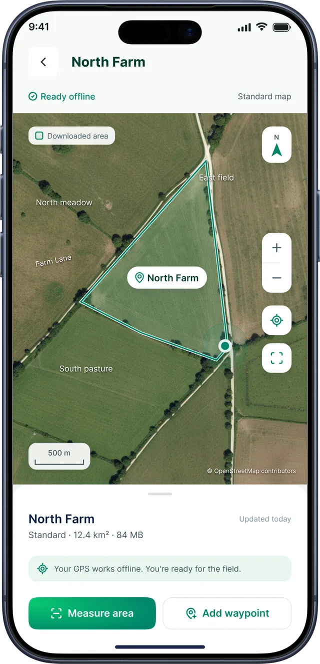
Download the map for a farm or site before you head out. GPS works without mobile data, so you can open the map, measure an area and add waypoints even where there's no coverage.
- Download any area and see its size and storage before you save
- Ready-offline maps you can open, update, rename or remove
- Measure areas and add waypoints on a downloaded map
- Storage at a glance with download progress and Wi-Fi status

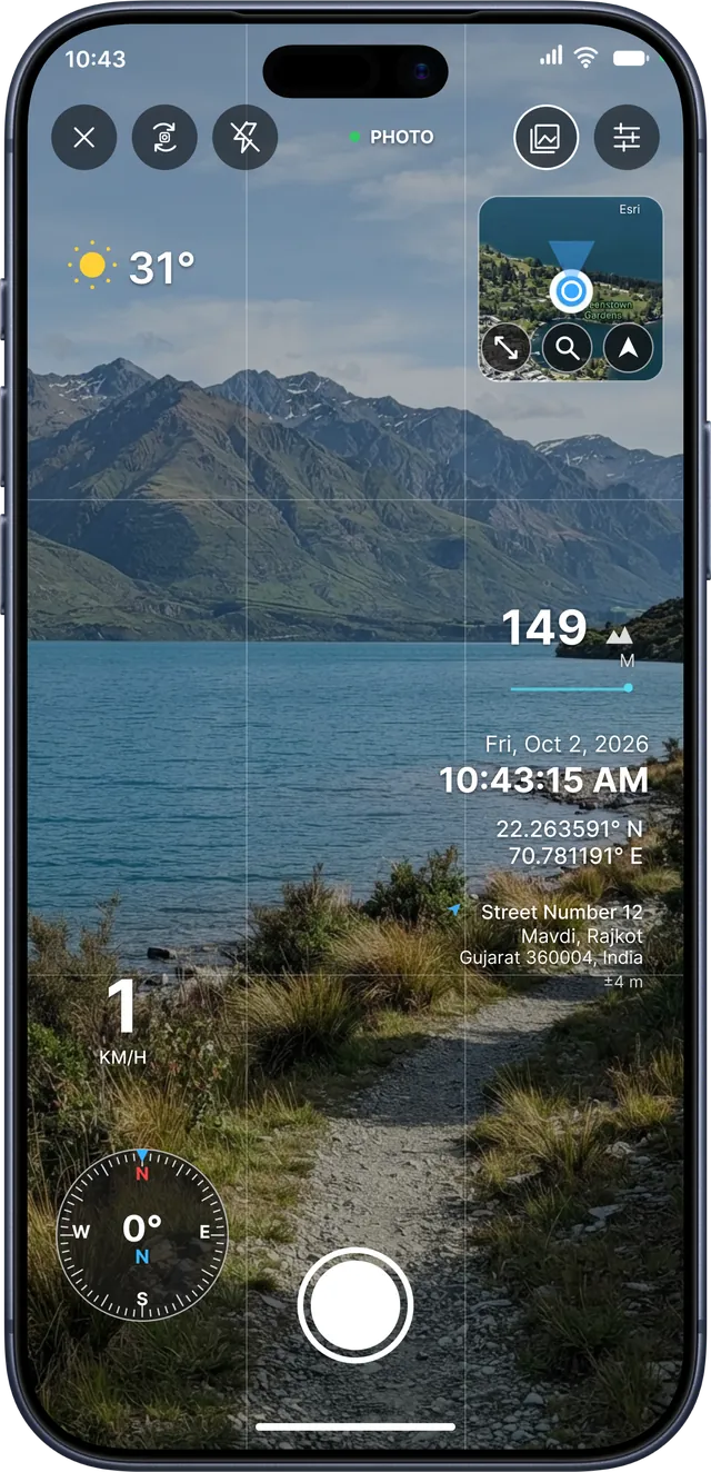
Photo proof of every field visit
The GPS Map Camera stamps each photo with coordinates, address, altitude, date and time, plus a mini map and compass heading — ideal for crop surveys, site inspections and land records. GPS Notecam adds notes and timestamps to your shots.
- Coordinates, address and altitude on every photo
- Date, time and time zone for reliable records
- Mini map, compass heading and temperature overlays
- Live GPS accuracy so you know when a fix is good
20 field tools, one app
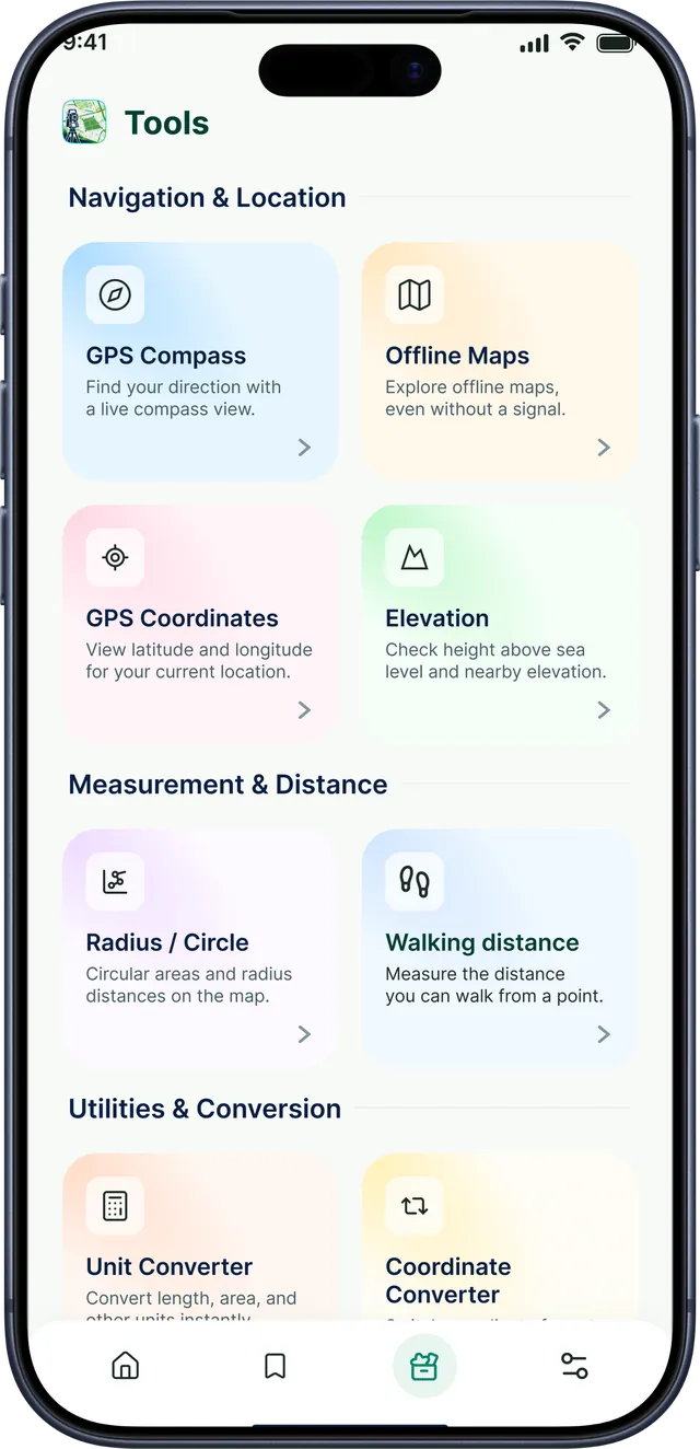
From a GPS compass and elevation meter to area, length and coordinate converters — everything you need to measure, record and share land data.
Field measuring
-
Area Measuring
Tap the corners of a field on the satellite map to get its area instantly.
-
Distance
Measure straight lines and multi-point routes between any points.
-
Perimeter
Total boundary length of a plot for fencing and planning.
-
Radius / Circle
Circular areas and radius distances from a centre point.
-
Way Points
Save key points on your route to come back to later.
-
Walking Distance
See how far you can walk from any point on the map.
GPS & offline maps
-
GPS Compass
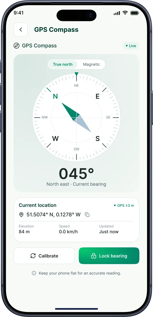
True-north or magnetic heading with calibrate and lock bearing.
-
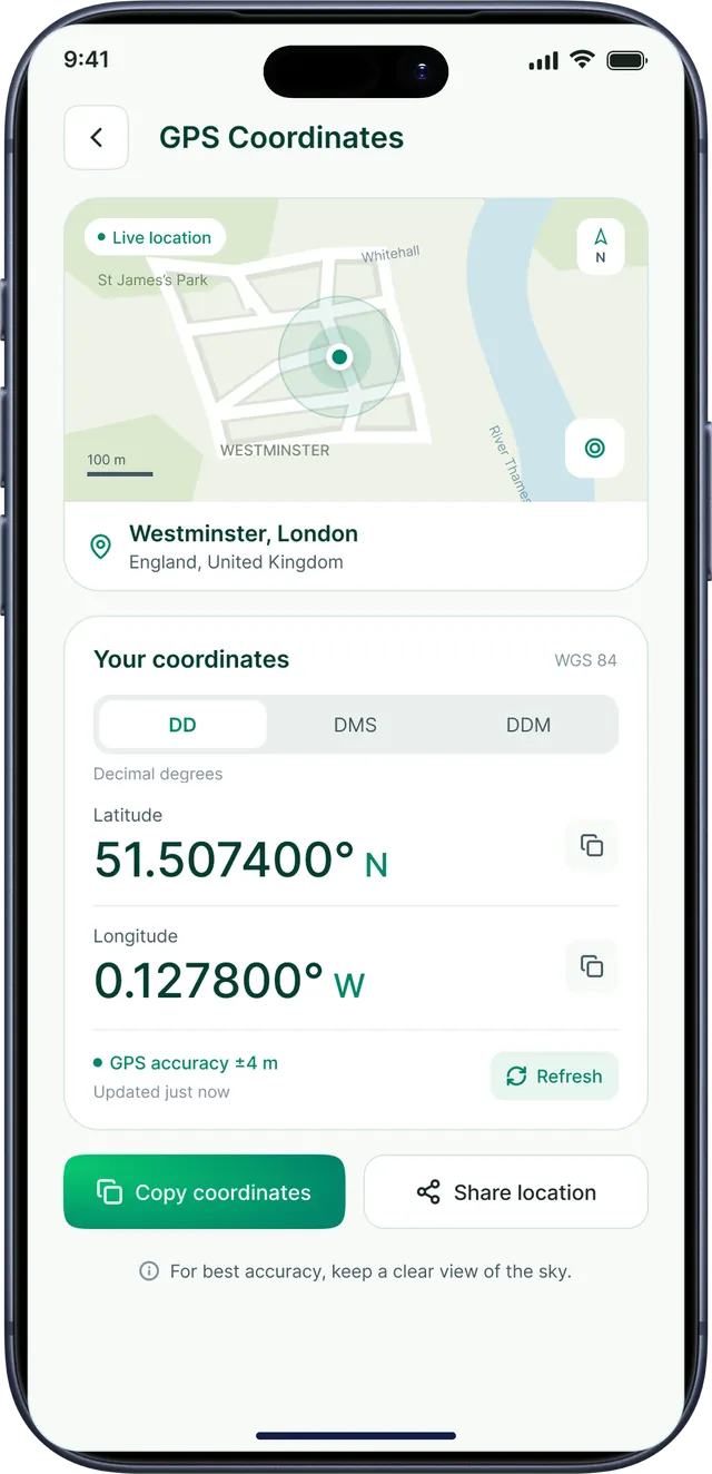
GPS Coordinates
Latitude and longitude in DD, DMS or DDM with live accuracy.
-
Elevation
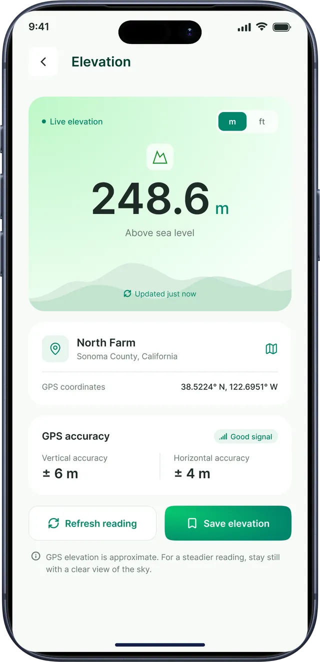
Height above sea level with vertical and horizontal GPS accuracy.
-
Offline Maps
Download field areas and keep working without a signal.
-
Map Types
Switch between standard, satellite and terrain maps.
GPS camera
-
GPS Map Camera
Photos stamped with coordinates, address, altitude, date and time.
-
GPS Notecam
Save notes and photos with GPS location and timestamps.
Converters
-
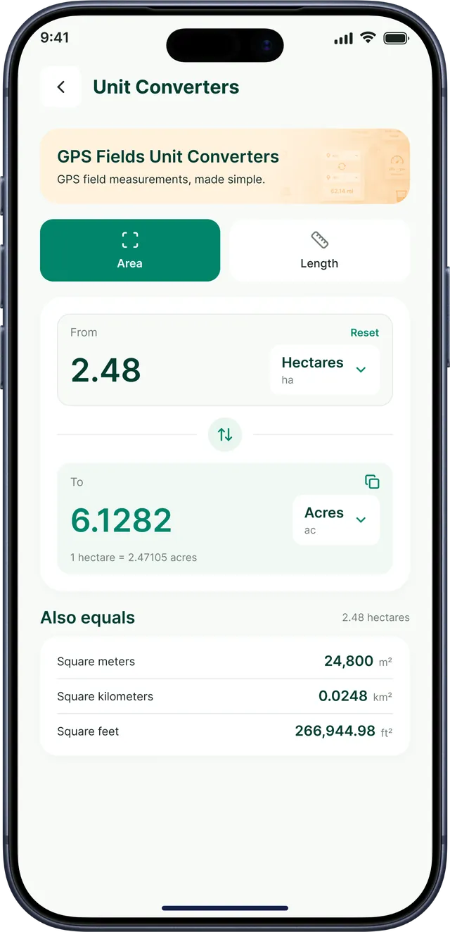
Area Converter
Hectares, acres, square meters, square feet and more.
-
Length Converter
Kilometers, miles, meters, feet, yards and more.
-
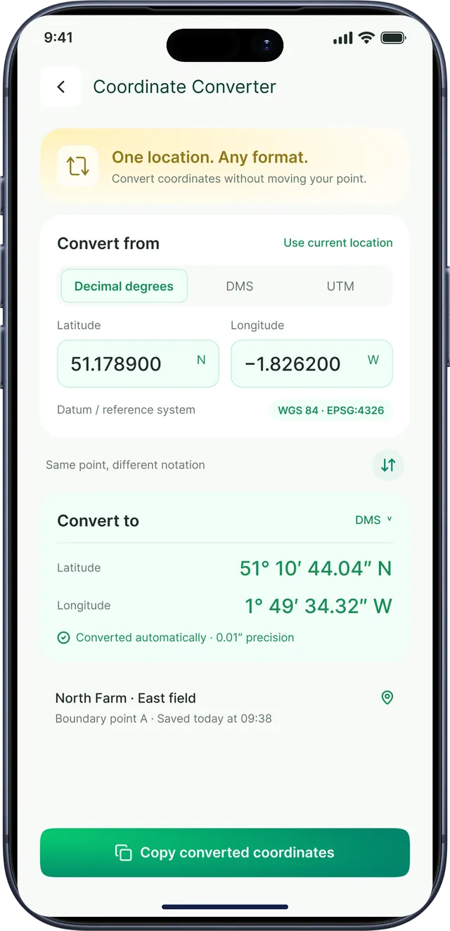
Coordinate Converter
Convert coordinates between decimal degrees, DMS and UTM.
Files & sharing
-
Import Files
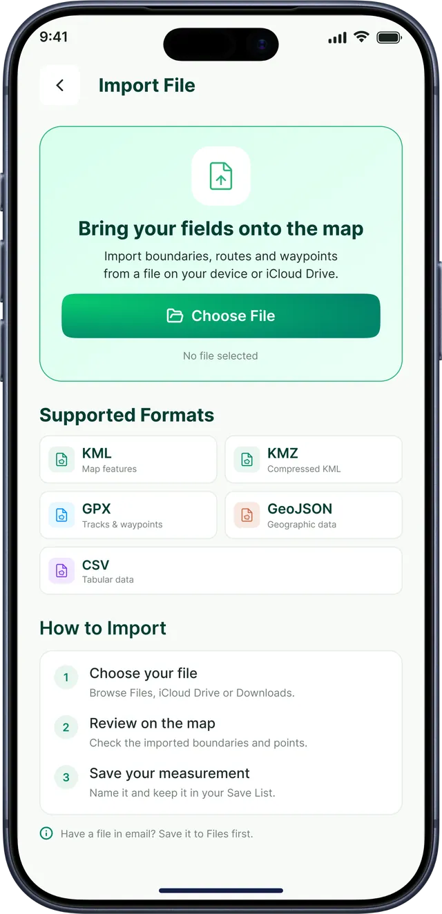
Bring in boundaries, routes and waypoints from KML, KMZ, GPX, GeoJSON or CSV.
-
Export Files
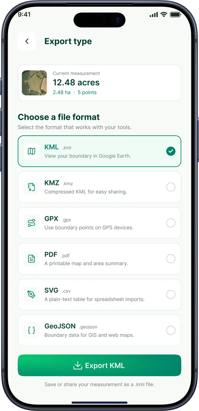
Save a measurement as KML, KMZ, GPX, GeoJSON, PDF or SVG.
-
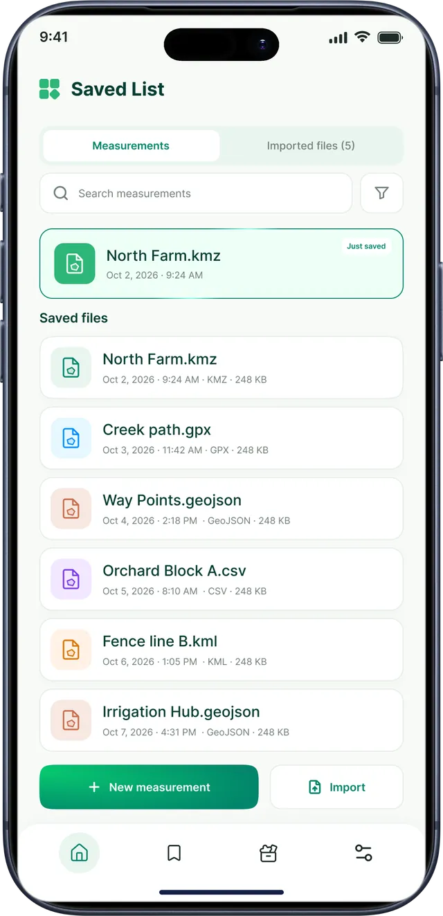
Saved List
Search and reopen every measurement and imported file.
-
Share
Send a measurement file through any app or save it to Files.
Built for the field, not the office
Big numbers, clear maps and every tool one tap from home — easy to use in bright sun with one hand.
Works with the files you already use
Bring existing boundaries, routes and waypoints onto the map, then save every measurement as a file for Google Earth, GPS devices, GIS software or a printed report. Name it, save it to Files or share it in a tap.
- Acres
- Hectares
- Square meters
- Square kilometers
- Square feet
- Square yards
- Square miles
- Kilometers
- Meters
- Miles
- Feet
- Yards
- Inches
- Centimeters
- Millimeters
Permissions that make sense
Here's why GPS Field Area Measurement asks for each permission — and you can change your choices anytime in your phone's settings.
Location
Shows where you are on the map and powers GPS coordinates, elevation, the compass and photo stamps.
Camera
Used only when you open the GPS Map Camera or GPS Notecam to take location-stamped photos.
Motion & sensors
Reads your phone's compass and motion sensors for heading and bearing.
Files & photos
Lets you import KML, GPX and other files, and save your exports and stamped photos.
Read the full Privacy Policy, Terms & Conditions and Refund Policy.
What is GPS Field Area Measurement?
GPS Field Area Measurement is a mobile app by TechKhedut for measuring land area, distance and perimeter on satellite maps. It also includes offline maps, a GPS map camera, a GPS compass, elevation and coordinate tools, unit converters, and file import and export — 20 field tools in one app.
Is GPS Field Area Measurement available on iPhone and Android?
GPS Field Area Measurement is coming soon to Google Play for Android and the App Store for iPhone. Download links appear on this page as soon as each store listing is live.
How do I measure the area of a field?
Open Area Measuring, switch to the satellite map and tap each corner of the field. The area updates as you add points and is shown in your chosen unit, such as acres or hectares. Drag any point to adjust the boundary, then save or export the measurement.
How accurate are the measurements?
Area and distance are calculated from the points you place on the map, so accuracy depends mostly on how precisely you place them — zoom in on the satellite view for the best results. Live GPS readings such as coordinates, elevation and photo stamps depend on your phone's GPS, and the app shows the current accuracy (for example ±4 m) so you know how reliable a reading is.
Does the app work without internet?
Yes, with offline maps. Download the map for your field or site while you are connected. GPS keeps working without mobile data, so you can open the downloaded map, measure an area and add waypoints out in the field.
Which units can I measure in?
Area: acres, hectares, square meters, square kilometers, square feet, square yards, square miles. Length: kilometers, meters, miles, feet, yards, inches, centimeters, millimeters. You can switch units at any time, and the built-in converters show the equivalent values.
Which file formats can I import and export?
You can import KML, KMZ, GPX, GeoJSON, CSV files, and export measurements as KML, KMZ, GPX, GeoJSON, PDF, SVG to open them in Google Earth, GPS devices or GIS software, print them, or share them with others.
Which permissions does the app need?
Location powers the map, GPS coordinates, elevation and photo stamps; the camera is used for the GPS Map Camera and GPS Notecam; motion sensors power the compass; and file access lets you import files and save your exports. You can change these choices any time in your phone's settings. See the privacy policy for details.
Who is GPS Field Area Measurement for?
Farmers, land surveyors, real estate agents, builders and contractors, landscapers, fencing and irrigation planners, and anyone who needs to measure land, record a site visit or share a boundary.
Measure your next field in seconds
GPS Field Area Measurement is coming soon to Google Play for Android and the App Store for iPhone.
Privacy Policy Terms & Conditions Refund Policy Support
Designed & developed by TechKhedut — see our iOS and Android app development services.